Marine Navigation Systems
The most common problem of seafarers from past to present was undoubtedly making short and safe journeys on long journeys. This was not easy since there were no technological devices used today in the period. What are the navigation systems used in maritime? XI. Until the beginning of the 18th century, it was possible to find direction, to determine how much distance was left and whether there was any danger with the chance and good observation of people. XX. If we talk about what navigation methods are used up to yy. While navigation tools were not available, sailors had developed methods and some tools that could be used instead. Of course, this process did not develop suddenly and this progressed with many years of observation and experience.
One of the most dreaded issues at that time was when seafarers were most frightened when ships landed or hit any rock. For this reason, seafarers mostly prefer to depart during the day and anchor in quiet and safe bays at night. With the development and increase of maritime trade during the antiquity, the journey times became shorter and safer routes became very important. In this period, the most preferred and accepted as the center of trade was the Mediterranean. During this period, ancient Egyptian seafarers, who actively used in the Mediterranean, often used sounder reeds or wind roses to measure the depth of the water.
On the other hand, the ancient Greeks used a rope tied to the end of the rope to the sea and tried to measure the depth of the water. With this method, they could also determine exactly where they were from the adhering sand, gravel or mud. In ancient times, seafarers had found a primitive navigation system that consisted of winds, soundings, stars, and solar movements.
It was a little easier to guess where they were while sailors were cruising in the coastal areas. The most important method to find directions in the open seas was to look at the sun and the stars. While the sailors with sufficient experience in this regard moved in the east-west direction during the day, at night, some constellations were determined according to their location. When the methods used are taken into account, it is seen how difficult and realistic and reliable it is to find directions and calculate distances in that period. Between 900 and 1000, the Vikings were able to reach Greenland and Iceland using only the stars, the sun, and the wind. Since the seasonal conditions in the Northern seas and the Mediterranean are not the same, it is not safe to watch in the Mediterranean with this method. There was a navigation method with help from Raven birds, developed by Viking Explorer Floki Vilgjerdarsson.
This method was only suitable for use when the ship approached the land. Considering that the land was approached according to the method, the Raven bird was released and the direction towards which the bird was directed was moving. It showed that there was land in the area where the bird was moving. If the bird wandered around the boat instead of going in a certain direction, it would show that they were not close to the land. Locals living on the island of Hawaii were getting help from a water container that they emptied to measure with latitude degrees. With this water bowl, the sailors looking at the Pole star could see if they were at the same latitude as the island. The method used by the Polynesians to locate their islands was branch maps tied with ropes. They were able to find their directions and islands while they were cruising with the maps they created with a special technique.
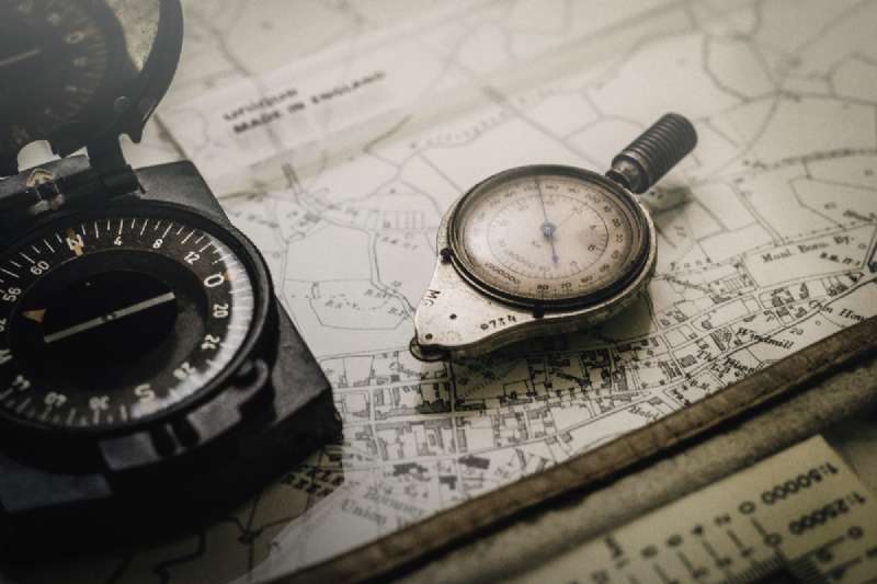
The oldest of the navigation devices made with human hands was undoubtedly the sailor's compass. These compasses, which were originally used to observe the polar star and the sun, were extremely primitive instruments. Since this compass was used to point to the magnetic north rather than true north, it was not so reliable among sailors. Nevertheless, it was a compulsory vehicle for the winds during the determination of the wind. The navigation data generated by the seafarers at that time were brought together to form maps called portolan. However, these maps were not enough to measure distances and were filled with many errors. Therefore, its use was not healthy.
The magnetic compass developed in the 13th century was very similar to today's compasses. The compasses were used until the 1700s to create maps that could show magnetic variation but were still not very useful. One of the most important navigation devices used in those times was the lead sounder for measuring depths.
Over time, advances in mathematics and astronomy have enabled the more accurate and realistic reading of stars and solar movements. Thus, the calculation of latitude values has become easier and more accurate. To accomplish this, Arab societies used Kamal or astrolabe, while Europeans used tools called back bars and crossbars.
Kamal: this instrument is a simple instrument used by Arabs and serves as a latitude measurement.
Astrolabe: a tool used to measure the angle between a star and the horizon.
Cross Bar: this tool was used to measure the angle between the horizon and the sun or another star.
The bar at Back: It is a tool for measuring the angle between the horizon and the sun at noon. If the navigation devices used in the period were by the conditions of the region, the latitude degree could be estimated incorrectly up to 32 kilometers. The voltaic ruler, which began to be used since the 1400s, was an important navigation vehicle, especially used on sailing ships. Under period conditions, generally illiterate sailors were able to calculate the speed and wind direction of the ship from the nails on the voltaic ruler. After taking the necessary measurements, the captain of the ship was able to determine the position and progress accordingly.
Log Chip: It is the name given to the instrument which has been used since the 1400s and can measure the speed of the ship. In this method, knots were thrown on the rope every 13 meters. By keeping time, this rope was thrown into the sea and after a certain time, the rope was stopped. According to the number of nodes on the rope, the speed of the ship in the hour would be shown as nautical miles.
Patent Flake: a very small brass cylinder with fins on it, which would work with the turnover system. This turnover system calculated the path the ship took. Thus, it was possible to determine how long the ship traveled and the speed of the ship.
Nocturnal: a kind of round calculator, it was used to calculate the average time of the region at sea between 1500-1600.
Quadrant: A type of navigation device used to measure the angle between the horizon and the Polar star between 1500-1700. A very important navigation device, the stopwatch used in the 18th century, was developed by John Harrison in 1764. This stopwatch allows time to be measured with a small margin of error and was very effective in calculating longitude. The stopwatch has remained one of the most preferred and most expensive navigation devices on board for many years. It remained popular until radio signals were found and widely used. XX.
With the introduction of radios on ships in the 16th century, both navigation and communication techniques changed completely. Marine navigation systems have been developed with great efforts and years of observation. Considering the conditions of that period, they are extremely important achievements.